SEAMLESS-WAVE

SEAMLESS-WAVE is a developing “SoftwarE infrAstructure for Multi-purpose fLood modElling at variouS scaleS” based on "WAVElets" and their versatile properties. The vision behind SEAMLESS-WAVE is to produce an intelligent and holistic modelling framework, which can drastically reduce iterations in building and testing for an optimal model setting, and in controlling the propagation of model-error due to scaling effects and of uncertainty due statistical inputs.
Modifying the resolution of the DEM on QGIS
QGIS can also be used to decrease (upscale) the resolution of the DEM data. For the Merewether test case, the original DEM file was at a 0.01 m x 0.01 m resolution but another file with a resolution of 0.175 m x 0.175 m is produced based on the following procedure:
- Load the original DEM following the steps in “Viewing the DEM data on QGIS”.
- Right-click on the DEM file name in Layers window and select Export - > Save as …
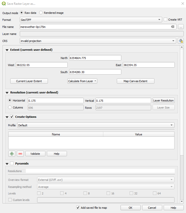
- In Save Raster Layer as … window, change both the Horizontal and Vertical resolution to 0.175, and check that the boundaries, or Extent, of the 2D domain accommodates the new resolution (in this example it must be: West: 382232.55, East: 382354.35, North: 6354664.775, South: 6354280.3). Enter a name for the new layer in the File Name section, namely
merewether-0p175m, and then click OK (see figure below). The newly created layer will be shown in the Layers window.
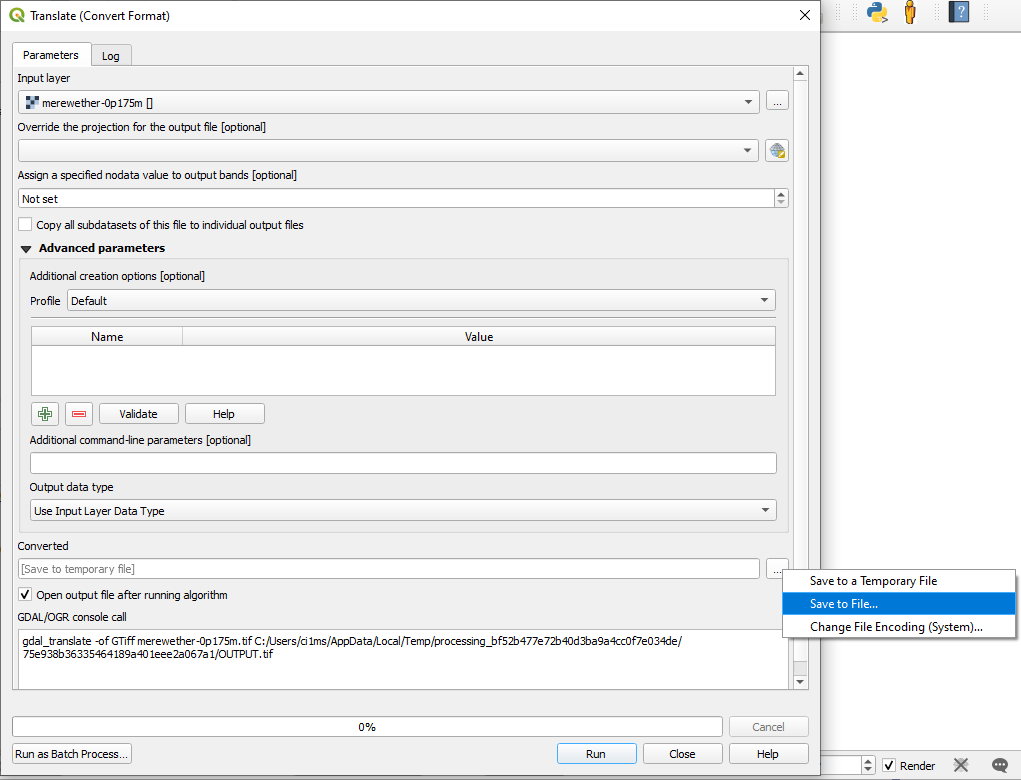
- Select the new layer in the Layers window and go to Raster - > Conversion - > Translate (Convert Format)…
- In the Translate (Convert Format) window, set Assign a specified nodata value to output bands as -9999 and click on Save to File… (see figure below).
- Save the file with
.ascextension, e.g.merewether-0p175m.asc. - Once saved, change the extension of the file from
.ascto.dem.
Hence, merewether-0p175m.dem will be the upscaled raw DEM file that will be used to set up LISFLOOD-FP simulations.
See also Ayog and Kesserwani (2021) to access the original and modified files on Zenodo.