SEAMLESS-WAVE

SEAMLESS-WAVE is a developing “SoftwarE infrAstructure for Multi-purpose fLood modElling at variouS scaleS” based on "WAVElets" and their versatile properties. The vision behind SEAMLESS-WAVE is to produce an intelligent and holistic modelling framework, which can drastically reduce iterations in building and testing for an optimal model setting, and in controlling the propagation of model-error due to scaling effects and of uncertainty due statistical inputs.
Merewether urban flooding
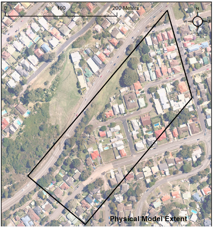
This test case is based on a physical model constructed to simulate the flooding flow pathways in an urban area with pier- and slab-supported buildings in Merewether, Newcastle, Australia (Smith et al., 2017). The model was 12.5 m long by 5 m wide, scaled (30:1 horizontal, 9:1 vertical) to the prototype shown in the figure below.
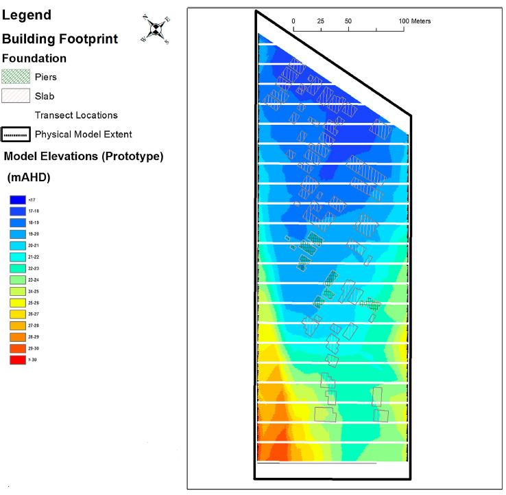
The model DEM, water level and velocity data were recorded relative to an arbitrary datum (at model scale) and were transformed to prototype scale using known survey points and the Froude scaling relationships. These data files are available for download through the Water Research Laboratory of University of New South Wales Australia Data Warehouse website. An overview of the DEM, including the location of buildings and the inflow (bottom right corner), is shown in the figure below. The physical model experiments were run under a steady flow rate of 19.7 cubic metres per second.
In the rest of this section, an overview of the LISFLOOD-FP modelling environment is provided through a step-by-step guide for setting up and running the Merewether urban flooding test case; see also Ayog and Kesserwani (2021).